winter landscape

JFK Airport Sunrise, Queens New York
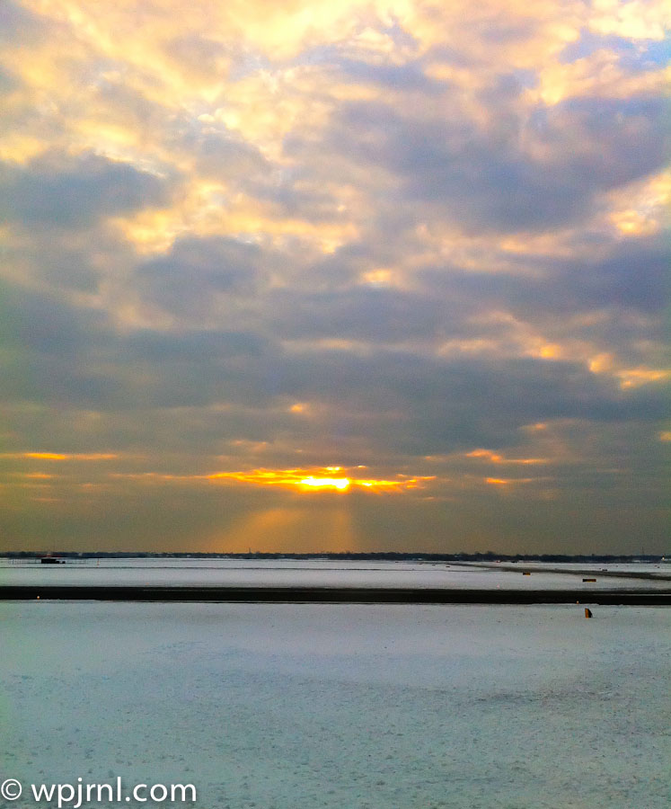
JFK Airport Sunrise, Queens New York
A stunning golden sunrise over JFK’s tidal marshes creates a serene moment of natural beauty in the midst of urban aviation.

John F. Kennedy International Airport, located in Queens, New York, is one of the world’s busiest airports, but it also offers unexpected moments of natural beauty. After winter snow storms clear the skies, dawn breaks over the airport’s unique landscape of salt marshes, water basins, and tidal areas, creating breathtaking photographic opportunities. The interplay of light, water, and cloud formations during sunrise transforms this industrial setting into a place of remarkable tranquility.

The Jamaica Bay wetlands surrounding JFK provide a striking contrast to the airport’s runways and terminals, offering visitors and photographers a glimpse of nature thriving alongside modern infrastructure. Early morning light casts golden rays across still water and pristine snow-covered landscapes, making the post-storm sunrise particularly magical.

Whether you’re catching an early flight, working at the airport, or simply seeking a unique vantage point for sunrise photography, JFK’s natural surroundings reveal an often-overlooked dimension of this iconic New York location.

Highlights

  • Stunning sunrise views over Jamaica Bay marshlands with dramatic cloud formations
  • Post-snow storm clarity creates exceptional visibility and golden light photography
  • Unique blend of natural wetlands and aviation infrastructure creating striking contrasts
  • Early morning tranquility before the airport’s busy daytime operations begin

What to Do

  • Arrive before dawn to photograph the sunrise over the tidal marshes and water basins
  • Explore viewing areas accessible from the airport’s perimeter roads
  • Observe migrating birds and wildlife in the Jamaica Bay wetlands
  • Capture the interplay of natural light on water and snow-covered landscapes

Best Time to Visit

Winter mornings after snow storms, when clear skies and fresh snow create optimal sunrise photography conditions with dramatic lighting and pristine landscapes.

Getting There

JFK Airport is accessible via the AirTrain Jamaica or AirTrain Howard Beach, connecting to the subway and rail systems. Drive access is available via the Van Wyck Expressway. Perimeter roads offer viewing points for sunrise photography.

Visitor Tips

  • Arrive 30-45 minutes before sunrise for optimal light and positioning
  • Check weather forecasts after snow storms for clearest skies and visibility
  • Bring appropriate winter clothing and waterproof gear for snow and marsh conditions
  • Have your camera ready as sunrise lighting changes rapidly
  • Respect airport security and stay in public access areas only

Nearby

  • Jamaica Bay Wildlife Refuge for birdwatching and nature walks
  • Rockaway Beach for Atlantic Ocean views
  • Floyd Bennett Field historic airfield site
  • Canarsie Pier for waterfront views

The sunrise at JFK Airport after a snow storm reveals the hidden natural splendor within one of America’s busiest aviation hubs. This unexpected moment of serenity—where golden light dances across pristine snow and calm waters—reminds us that beauty exists in the most unlikely places. Whether you’re a photographer seeking that perfect shot or a traveler with time before your flight, take a moment to witness the magical transformation of Jamaica Bay at dawn.

Location Map

JFK Airport Sunrise, Queens New York Read More »
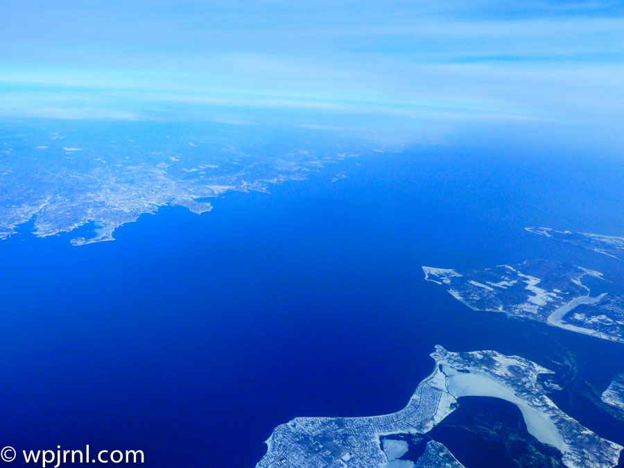
New York Aerial Winter Landscape, New York USA

New York Aerial Winter Landscape, New York USA
Witness the frozen beauty of New York’s archipelago and waterways from above during winter’s crisp season.

This stunning aerial photograph captures New York’s intricate geography during winter, revealing the complex network of islands, waterways, and coastal development that defines this iconic region. From thousands of feet above, the contrast between the deep blue waters and snow-covered land creates a breathtaking winter landscape. The view showcases the Hudson River, East River, and numerous islands that form the foundation of New York City’s unique metropolitan layout, frozen in time during the coldest season.

Highlights

  • Aerial perspective of New York’s frozen waterways and islands in winter
  • Clear visibility of the Hudson River and East River systems
  • Snow-covered landscapes contrasting with deep blue water
  • Bird’s-eye view of New York’s complex coastal geography

What to Do

  • Fly over New York City to capture aerial photography similar to this view
  • Visit observation decks like the Empire State Building or One World Observatory for elevated city views
  • Explore the islands and waterfronts by boat or helicopter tour
  • Experience winter activities across the city’s parks and outdoor spaces

Best Time to Visit

Winter (December to February) offers clear skies, snow-covered landscapes, and exceptional visibility for aerial photography

Getting There

Fly into one of New York’s three major airports: JFK, LaGuardia, or Newark. Helicopter tours depart from various locations in Manhattan.

Visitor Tips

  • Book helicopter or airplane tours early for the best aerial photography opportunities
  • Winter weather provides clearer atmospheric conditions for aerial shots
  • Dress warmly if taking open-door aerial photography flights
  • Visit during midday for optimal lighting conditions

Nearby

  • Manhattan skyline and urban landscape
  • Statue of Liberty and Liberty Island
  • Central Park winter scenery
  • Brooklyn Bridge and East River waterfront

Seeing New York from above transforms your understanding of this magnificent city. The aerial winter perspective reveals nature’s intricate artistry alongside human development, creating a humbling reminder of the scale and complexity of one of the world’s greatest metropolitan areas. Plan your aerial tour today and witness New York’s breathtaking geography from a perspective few experience.

Location Map

New York Aerial Winter Landscape, New York USA Read More »

Scroll to Top