landscape photography

Rice Fields Landscape, Bali Indonesia
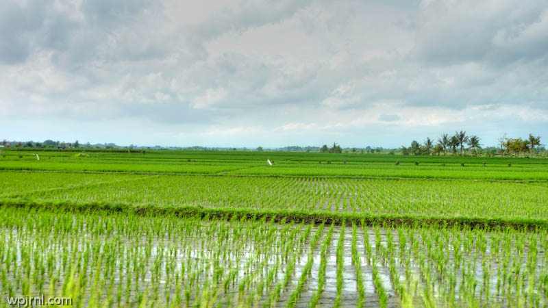
Rice Fields Landscape, Bali Indonesia
Emerald terraces of cascading rice paddies that showcase Bali’s agricultural heritage and stunning natural beauty.

The rice fields of Bali are among the most iconic and breathtaking landscapes in Southeast Asia, representing centuries of sophisticated agricultural tradition. These lush green terraces stretch across the island in mesmerizing patterns, fed by an intricate system of irrigation channels called the Subak. The paddies transform throughout the seasons, from vibrant green during growing season to golden harvests, creating an ever-changing canvas of natural beauty that has captivated visitors and photographers for generations.

These agricultural lands are far more than just functional farms—they are a reflection of Balinese culture, spirituality, and harmony with nature. The terraced system demonstrates remarkable engineering and sustainable farming practices that have been perfected over more than a thousand years. Walking through these fields offers a peaceful escape from modern life and an opportunity to witness traditional farming methods that continue to feed local communities.

Highlights

  • Terraced paddies with stunning geometric patterns visible from elevated viewpoints
  • Subak irrigation system—UNESCO-recognized traditional water management infrastructure
  • Abundant birdlife and native flora throughout the farming landscape
  • Traditional farming methods still practiced by local farmers
  • Dramatic seasonal changes offering varied visual experiences year-round

What to Do

  • Trek through the rice fields on foot to experience the paddies up close and meet local farmers
  • Photograph the layered terraces during sunrise or sunset for golden hour lighting
  • Visit nearby villages like Tegallalang to stay immersed in rural Balinese life
  • Take a guided tour to learn about traditional farming techniques and the Subak system
  • Enjoy meals at restaurants overlooking the fields for an authentic dining experience

Best Time to Visit

April to June offers the most spectacular scenery with vibrant green paddies at peak growth, while September to November showcases golden harvests. The dry season (May to September) generally provides the clearest skies for photography.

Getting There

Most rice fields are accessible by car or scooter from central Bali. Tegallalang rice terraces near Ubud are the most visited—approximately 1.5 hours from Denpasar by road. Local guides and organized tours are available from major towns.

Visitor Tips

  • Wear comfortable walking shoes with good grip as pathways can be muddy and slippery
  • Bring sun protection including hat, sunscreen, and plenty of water
  • Respect working farmers and ask permission before photographing people or their land
  • Visit early morning to avoid crowds and capture the best light
  • Be mindful of the delicate ecosystem—stay on designated paths to protect the paddies

Nearby

  • Tegallalang Village with traditional handicraft workshops
  • Ubud Palace and cultural district
  • Sacred Monkey Forest Sanctuary
  • Tirta Empul Temple with sacred spring water pools

The rice fields of Bali offer an incomparable experience of natural beauty intertwined with cultural significance. Whether you come to photograph the stunning terraces, trek through the emerald landscape, or simply sit and absorb the peaceful atmosphere, these paddies will leave an indelible mark on your heart. This is where tradition meets pristine nature, and where every step through the fields connects you to generations of Balinese heritage and wisdom.

Location Map

Rice Fields Landscape, Bali Indonesia Read More »
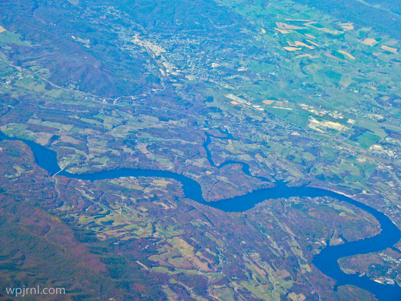
Aerial View of River Valley, Boreal Forest Region

Aerial View of River Valley, Boreal Forest Region
A stunning aerial perspective of pristine wilderness where meandering rivers carve through vast forests and patchwork farmland.

This breathtaking aerial photograph captures the raw beauty of Canada’s boreal forest landscape from thousands of feet above. The image reveals the intricate patterns of nature—sinuous blue rivers winding through dense forests, cleared agricultural land in vibrant greens and yellows, and the subtle textures of the northern wilderness. Shot from a plane window, this perspective offers a humbling reminder of the vastness and untamed character of Canada’s northern regions, where civilization exists in careful balance with the natural world.

Highlights

  • Dramatic meandering river system creating natural curves through the landscape
  • Contrast between dense boreal forest (dark purple-blue tones) and cultivated farmland (bright greens and yellows)
  • Aerial perspective revealing the scale and vastness of northern wilderness
  • Pristine waterways reflecting sunlight in brilliant blues

What to Do

  • Fly over the boreal forest to experience this remarkable landscape from above
  • Explore river valleys by canoe or boat during summer months
  • Visit northern communities like Fort McMurray or Prince George for ground-level access to these regions
  • Photograph the landscape during different seasons for varying colors and perspectives

Best Time to Visit

Late spring through early autumn (May-September) when weather is stable for aerial tours and the landscape shows vibrant greens and accessible waterways

Getting There

Regional airports in northern Canada such as Fort McMurray International Airport or Prince George Airport offer connections. Charter flights and scenic air tours provide the best aerial viewing experience.

Visitor Tips

  • Book scenic flights early in the day for better lighting and clearer views
  • Window seats on the left side typically offer the best photography angles
  • Bring a polarizing filter if photographing through aircraft windows to reduce glare
  • Check weather conditions before booking aerial tours for optimal visibility

Nearby

  • Fort McMurray Oil Sands Region
  • Athabasca River
  • Northern Alberta Wilderness
  • Peace River Valley

The boreal forest from above is a testament to nature’s grand design and Canada’s vast, unspoiled wilderness. Whether you’re a photographer seeking dramatic landscapes, an adventurer yearning for remote exploration, or simply someone who appreciates Earth’s natural beauty, experiencing this aerial view of northern forests and winding rivers will leave you awestruck and deeply connected to the land.

Location Map

Aerial View of River Valley, Boreal Forest Region Read More »

Scroll to Top