Aerial View of Santiago de Chile Valley, Chile
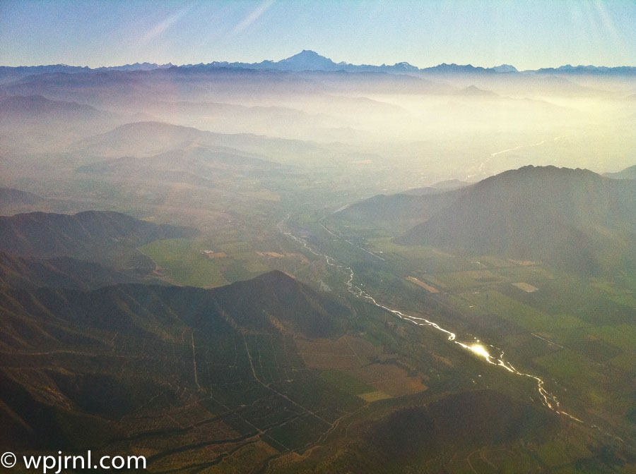
This stunning aerial photograph captures Santiago de Chile from above during landing, revealing the city’s dramatic geographical setting. Cradled in a vast valley with the snow-capped Andes Mountains forming a stunning backdrop, Santiago is one of South America’s most beautifully positioned capitals. The winding river cutting through the lush landscape and the layers of atmospheric haze create a serene, almost ethereal quality that showcases the region’s natural splendor and the city’s integration within its mountainous surroundings.
Highlights
- Panoramic views of the Andes Mountains, including peaks visible on the horizon that frame the city perfectly
- The winding river valley that flows through the landscape, providing fresh water and natural beauty
- Atmospheric layers and morning mist that create a sense of depth and scale across the terrain
- Diverse elevation changes showing the city’s unique position nestled between valleys and mountain ranges
What to Do
- Take scenic flights or helicopter tours to experience similar aerial perspectives of the city and surrounding landscape
- Visit nearby mountain attractions like San Cristóbal Hill for elevated city views
- Explore the Andes foothills and national parks surrounding the capital
- Visit local lookout points to appreciate Santiago’s geographical setting
- Take day trips to nearby wine valleys and mountain communities
Best Time to Visit
Late spring through early autumn (November to March) offers the clearest skies and best visibility of the Andes, though early morning flights provide the most atmospheric haze effects like in this photo
Getting There
Fly into Comodoro Arturo Merino Benítez International Airport, located approximately 15km west of downtown Santiago. Most international flights arrive here, offering aerial views similar to this photograph during approach and landing.
Visitor Tips
- Book early morning flights to experience the dramatic atmospheric lighting and mist patterns shown in this image
- Window seats on the left side of westbound flights offer the best views of the Andes approach
- The view is particularly stunning during clear weather in the dry season
- Bring a camera with good zoom capability to capture aerial details during your flight descent
Nearby
- San Cristóbal Hill for urban viewpoints
- Maipo Valley wine region
- Cajón del Maipo mountain refuge and hiking
- Farellones ski resort
- El Morado Natural Monument
Seeing Santiago from above is a transformative experience that immediately conveys why this city captivates visitors and residents alike. From the window of an aircraft descending toward the capital, you witness the harmonious relationship between urban development and natural geography that defines Chile’s most vibrant metropolis. Plan your visit to Santiago and experience this remarkable city where modern culture thrives beneath the watchful gaze of ancient mountain peaks.
Location Map
Aerial View of Santiago de Chile Valley, Chile Read More »