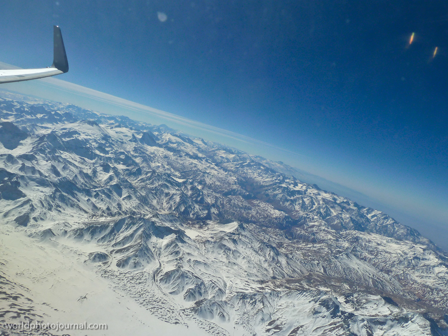
The Andes Mountains form the backbone of South America, stretching over 4,000 miles along the western edge of the continent. This aerial view captures the raw majesty of this UNESCO World Heritage-worthy landscape, with its towering snow-covered peaks, deep valleys, and intricate ridgelines carved by millions of years of geological forces. From the window of an aircraft, the Andes reveal their true scale and grandeur, displaying the dramatic topography that has shaped the cultures, ecosystems, and history of the region.
Highlights
- Snow-capped peaks rising dramatically above the clouds with elevation exceeding 20,000 feet
- Intricate valley systems and ravines showing the geological complexity of the mountain range
- Clear alpine air providing exceptional visibility for aerial photography and observation
- Diverse ecosystems ranging from high-altitude tundra to cloud forests visible from above
What to Do
- Fly over the Andes on regional flights between major South American cities for unobstructed mountain views
- Trek through mountain passes and high-altitude trails in Peru, Ecuador, or Colombia
- Explore ancient Incan sites nestled within the Andean valleys and peaks
- Visit local indigenous communities and experience traditional mountain culture
- Photograph the dramatic landscape during sunrise or sunset flights
Best Time to Visit
May to September (dry season in the Southern Hemisphere) offers the clearest skies and best visibility for aerial views, with stable weather conditions throughout the region.
Getting There
Fly on regional airlines operating routes between major cities like Lima, Cusco, Quito, Bogotá, and La Paz. International flights connecting these hubs provide regular opportunities to view the Andes from above.
Visitor Tips
- Book window seats on early morning flights when visibility is typically best and lighting is optimal for photography
- Bring a good camera or smartphone with high resolution for capturing the dramatic landscape details
- Check flight routes in advance to ensure your flight path crosses the highest and most scenic portions of the range
- Consider altitude sickness when planning ground-based exploration of Andean regions
Nearby
- Machu Picchu, Peru – iconic Incan citadel in the Eastern Cordillera
- Lake Titicaca, Peru/Bolivia – world’s highest navigable lake between two Andean nations
- Cusco, Peru – historic Incan capital city nestled in the Andes
- Quito, Ecuador – capital city located high in the Andean valleys
- Torres del Paine, Chile – dramatic granite peaks in the southern Andes
The Andes Mountains from above offer an unforgettable perspective on one of Earth’s greatest natural wonders. Whether you’re flying across South America or planning a ground-based expedition, the stunning alpine scenery and rich cultural heritage of the Andes promise an adventure that will leave you in awe of nature’s magnificent architecture.