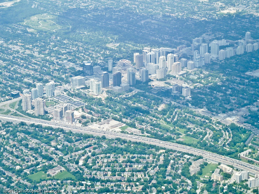
One of Toronto’s most vibrant urban intersections where city skyline meets suburban sprawl in this aerial perspective.
The intersection of Yonge and Sheppard represents a fascinating study in Toronto’s urban geography and development patterns. This aerial view captures the dynamic contrast between the dense high-rise residential and commercial core clustered in the center and the sprawling low-density suburban neighborhoods that characterize much of the Greater Toronto Area. Yonge Street, running north-south, is Canada’s longest street and serves as a major commercial and transit corridor, while Sheppard Avenue bisects the city east-west. This particular vantage point showcases the Sheppard subway line’s influence on urban density, with clusters of condominiums and office towers concentrated along the transit route.
Highlights
Aerial view of Toronto’s distinctive urban-suburban boundary
Sheppard Subway Line corridor with concentrated high-rise development
Major transportation infrastructure including highways and transit arteries
Contrast between dense commercial core and residential neighborhoods
Strategic commercial and retail hub in North York
What to Do
Visit the Yonge-Sheppard Centre shopping complex for retail and dining
Explore North York’s diverse neighborhoods and communities
Use the Sheppard Subway Station as a transit hub to access other Toronto attractions
Discover local restaurants and entertainment venues in the commercial district
Walk along Yonge Street’s bustling commercial corridor
Best Time to Visit
Year-round, though spring and fall offer pleasant weather for exploring the neighborhoods. Summer provides long daylight hours, while winter showcases urban architecture against clear skies.
Getting There
Easily accessible via the Yonge-Sheppard Subway Station on the Toronto Transit Commission (TTC) Line 4 Sheppard. Also reachable by car via Yonge Street (Highway 1) or Sheppard Avenue. Multiple bus routes serve the intersection.
Visitor Tips
The Yonge-Sheppard subway station is a major transit hub; plan accordingly during rush hours
The area is highly walkable with numerous pedestrian-friendly streets and sidewalks
Parking is available in various lots and underground facilities throughout the commercial district
This is primarily a commercial and residential area rather than a tourist destination, so plan activities accordingly
Nearby
North York Centre with city offices and cultural venues
Mel Lastman Square public plaza
Toronto’s diverse neighborhoods in North York
Easy transit access to downtown Toronto via Sheppard Subway Line
From above, the Yonge and Sheppard intersection tells the story of Toronto’s evolution as a dynamic North American city. This pivotal intersection represents the meeting point of urban density and suburban expansion, making it a compelling landmark for understanding the Greater Toronto Area’s unique geography and development patterns.